Our first assignment is to look at work that MFA DT students have accomplished in previous years that relates to our thesis domain. Here are a few that stood out or resonated with my interests which I see as precedents:
Crown Heights Mic
2014
by Salome Asega
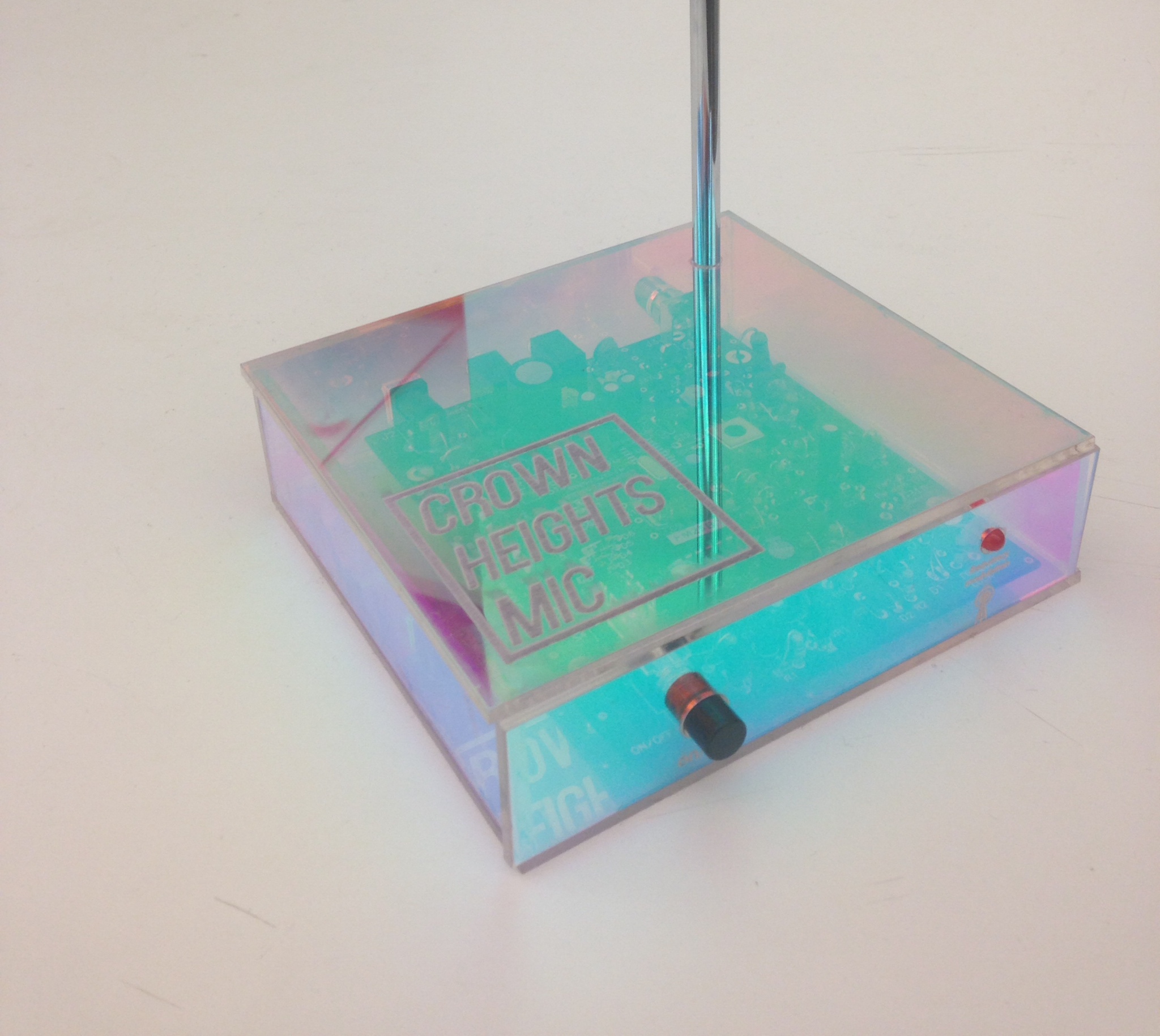
The Crown Heights Mic is a broadcast network collaboratively built by neighborhood stakeholders and residents. Through several sound funnels scattered around the neighborhood, we are able to hear the health of our neighborhood through each other’s voices. These sound funnels are planted on the side of buildings and strategically mapped in front of the sites we already congregate–schools, religious centers, and libraries. This network creates a safe and anonymous forum that is determined, used, and sustained by those of us present and on the streets.
Salome’s work has dealt with using participatory mapping to contest the process of gentrification in the Crown Heights neighborhood of Brooklyn, NY through the group Sidewalk Assembly which she co-directs. Additionally Salome wrote a research paper for the class Participatory Research and Social Inquiry on the methods she used around her thesis which I look forward to reading. Participatory mapping (and social justice in general) is a theme I am interested in focusing on within my own thesis, as it has been hailed as a solution to making the process of mapping more inclusive.
Skylines
2014
by Patricio González Vivo
We look at the horizon and see a skyline, the place where the earth and sky touch. This skyline is defined by the particular position of the observer - seeing through technical devices allows us to look beyond our perception into different qualities of time and space.
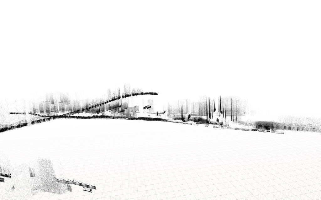
- Skylines 01: drawing machine that slowly reveals an image of the world viewed through the tireless eye of technology. It constantly adds traces of material, demonstrating that the drive for immediacy is not inherent in technology.
- Skylines 02: machine that prints the large-scale transitions of the horizon on a path from the city to the mountains. While Skyline #01 sees through the flow of the time, Skyline #02 expands our perception of space.
- Skylines 03: postcards revealing the invisible information of a city that is otherwise trapped inside corporate databases, freeing private information collected from public spaces.
Patricio’s work deals with themes of manipulating and utilizing data in experimental methods with tools such as Open Frameworks and Raspberry Pi. In particular his project Skylines III demonstrates using data he hacked from the Google Maps API to create a ghost like skeleton of NYC. Reappropriating technology for uses in which it was not originally intended is an important area in digital cartography I am interested in. Other hacks artists have done include using Google Maps Street View for example.
You Are Not Here
2013
by Shankari Murali
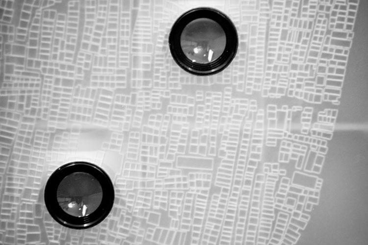
“You are Not here” seeks to represent urban spaces through a spectrum of lenses. Focussing on Dharavi, an informal township in Mumbai, it analyses the different spatial phenomena and practices associated with the space. Inspired by Henri Lefebvre’s lived-perceived-conceived triad, the lenses chosen to represent Dharavi are: the everyday, the spectacle and the imaginary. The everyday represents the space of the subject through the lens of a postman who deals with the everyday practicalities and difficulties concerned with delivering letters to the inhabitants of the settlement. The spectacle represents the objectified subject, seen and sold to the slum-tourist. The imaginary represents the objectified space, divided and distributed to planners who conceive new visions for the space.
Shankari’s work deals with confronting the contested perceptions of and power in urban space. This fits within cartography’s legacy as a tool used by government officials and planners in “top-down” processes that often excluded the perspectives of people living in the areas being redistricted and redeveloped as is often depicted on maps. “You Are Not Here” brings in humanistic elements to place that cartography often lacks in capturing, giving the viewer a more “bottom-up” depiction of place that maps cannot reproduce.
Tidepools
2012
by Jonathan Baldwin
Wireless mesh networks provide low-cost, shared Internet access to communities. Socially engaged users on these interconnected devices are also more resilient against threats that cripple centralized communication infrastructures, like censorship and natural disaster. However, for long term use, community networks need ritualized, face to face interaction between residents and localized incentives.
Working with the Red Hook Initiative and OTI at New America Foundation, Tidepools is tailoring custom social software. This project is based on local needs and interests of the Red Hook Housing Projects – in a remote area of Brooklyn, with little WiFi and Internet access primarily through Android phones.
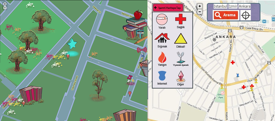
Visually inspired by local artwork, this “Ushahidi” meets “The Sims” hyper-local mapping web app is delivered to mobile and desktop devices through meshed WiFi routers. In this way Tidepools augment communication and civic awareness from the ground up, through modular, user-generated population of maps.
Tidepools evolved over months of community meetings, brainstorming sessions and feedback through a forum on the WiFi network. Creating and sharing custom maps emerged from the desire to plot Alerts of where police “stop and frisks” were occurring. Broken building signs led to integration of the Open311 civic reporting tool. Bus arrival alerts came from the sparse, inconsistent public transportation in the area. Spreading awareness of locations and times of Upcoming Meetings & Events soon followed.
For long term networks, API aggregation onto a global map and a community app marketplace stimulate a pan-regional, ecosystem of sharing. To counteract the instability of wireless grassroots networks past the community level, metropolitan and policy involvement is encouraged.
Jonathan’s Tide Pools project is relevant to my domain for it’s use of participatory research, civic engagement and open source mapping technology. Additionally Tide Pools proved to be an extremely useful asset following the destruction of Super Storm Sandy on October of 2012 in Red Hook, Brooklyn. Though the mesh network was not originally intended to assist vulnerable areas such as those prone to flooding, it assisted aid and relief workers during recovery:
On October 29, 2012, Superstorm Sandy devastated low-lying Red Hook along with much of the surrounding region. Amid power outages and flooding, the need for access to communications systems for information about what was happening and where help was needed became crucial. The RHI building was one of the few locations that had managed to keep power and, as a result, RHI WiFi had stayed up through the storm. In the days immediately following the storm, up to 300 people per day were accessing the network to communicate with loved ones, learn what was happening in the rest of the city, and seek recovery assistance.
One of my primary interests is how technology can improve life and solve problems in urban areas, particularly in places that have been historically marginalized by city officials and bureaucracies.