Presentaton
Slides from the presentation are available here.
Prototype
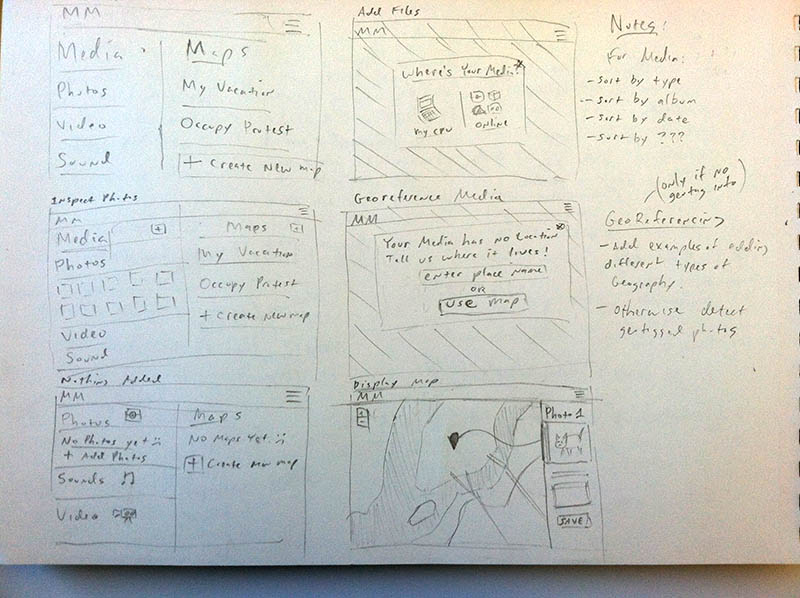
For this module I began to think about how to streamline the user experience of adding media to a map, or adding a spatial component to media. As a starting point I began to paper prototype an app:
This helped me to start thinking about refinements to the UI:
The user should be able to import geotagged photos in one of 3 methods:
- drag and dropping photos that are already geotagged.
- batch uploading multiple photos at a time that are already geotagged.
- manually setting the location for an un-tagged photo.
In steps one and two server side software will be able to extract a photo’s latitude and longitude coordinates from the photo’s meta data (exif-information).
The third option for manually setting a location could be accomplished by the user in one of two ways:
- the user enters the name of place (country, state/province, city, neighborhood).
- the user interacts with a web-map interface to add and place a marker.
The third option could be utilized for either single or multiple photos. More paper prototyping and user testing will help determine how to make this process more intuitive.
Design Brief
A PDF of the design brief may be viewed / downloaded here.