A Thru Hike on the Pacific Crest National Scenic Trail

"We try to plan for everything but in the end things outside our control will always dictate. Instead, we should try to live an 'uncalculated' life, not a life free of planning but a life with the understanding that not everything can be planned for." -Alan Watts

View of the Mojave Dessert from Kennedy Meadows in the Southern Sierra Nevada

I was elated, having quit my job not six days prior and finding myself in a completely foreign landscape with no remaining commitments other than walking for 2,650 miles and sleeping outside for the next five months.

The Pacific Crest Trail is a long distance hiking and equestrian trail that traverses western North America from the Mexican border just southeast of San Diego to the Canadian border northwest of Seattle. The trail is closely aligned with the highest portions of the Sierra Nevada and Cascade mountain ranges of California, Oregon and Washington. To hike the entire length in one calendar year is to "thru hike" the trail. To complete a thru hike, a hiker must time their arrival in the Sierra Nevada's after most of winters snow has melted in June but arrive at the Canadian border 2,660 miles later before heavy snow falls in late September. In the spring of 2013, Mike Henrick was one of several hundred hikers to thru hike the PCT.

Campo to Warner Springs - mile 109.5

Thursday, May 9, 2013

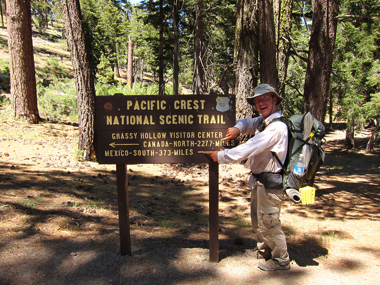
I arrived in San Diego looking much like Indiana Jones in my white fishing shirt, tan pants and over sized sun hat (no beard though). Rob Riess (a trail angel in San Diego) picked me up, let me sleep in his house, gave me a container of alcohol for my stove and drove me and two other hikes over an hour to the trail head at Campo.  I was elated, having quit my job not six days prior and finding myself in a completely foreign landscape and with no remaining commitments other than walking for 2,650 miles and sleeping outside for the next five months.

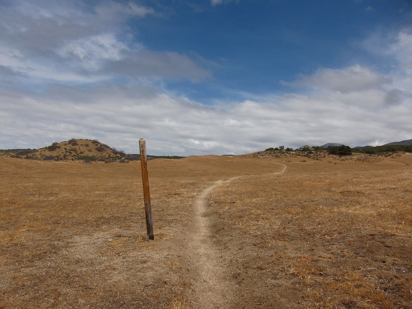
First steps on the trail

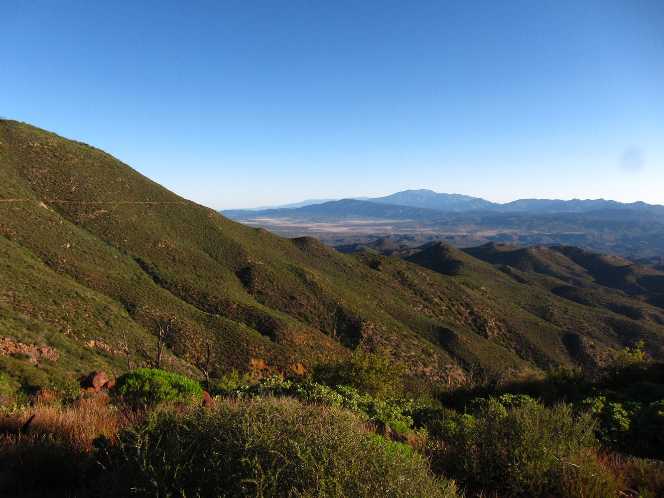
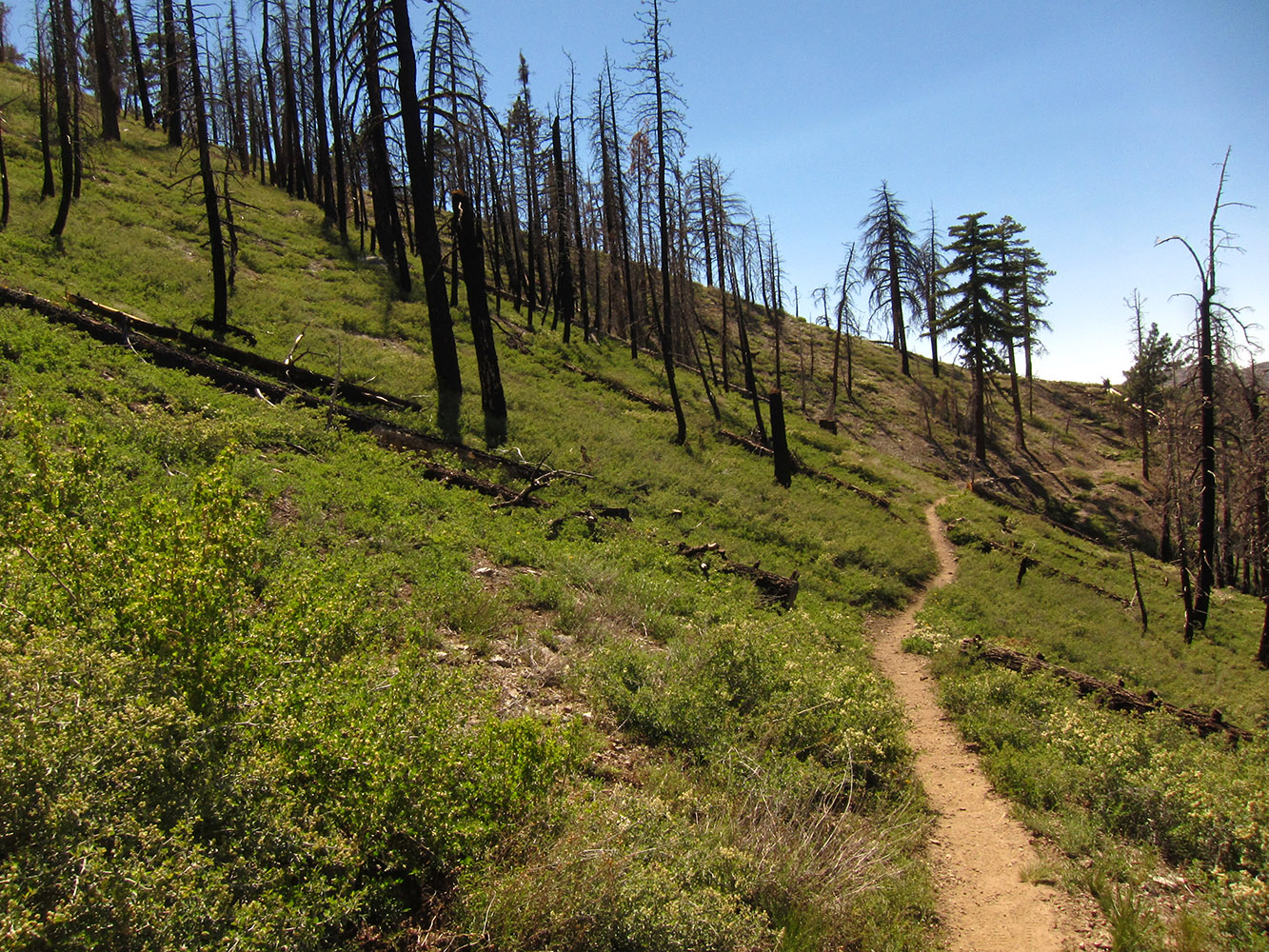
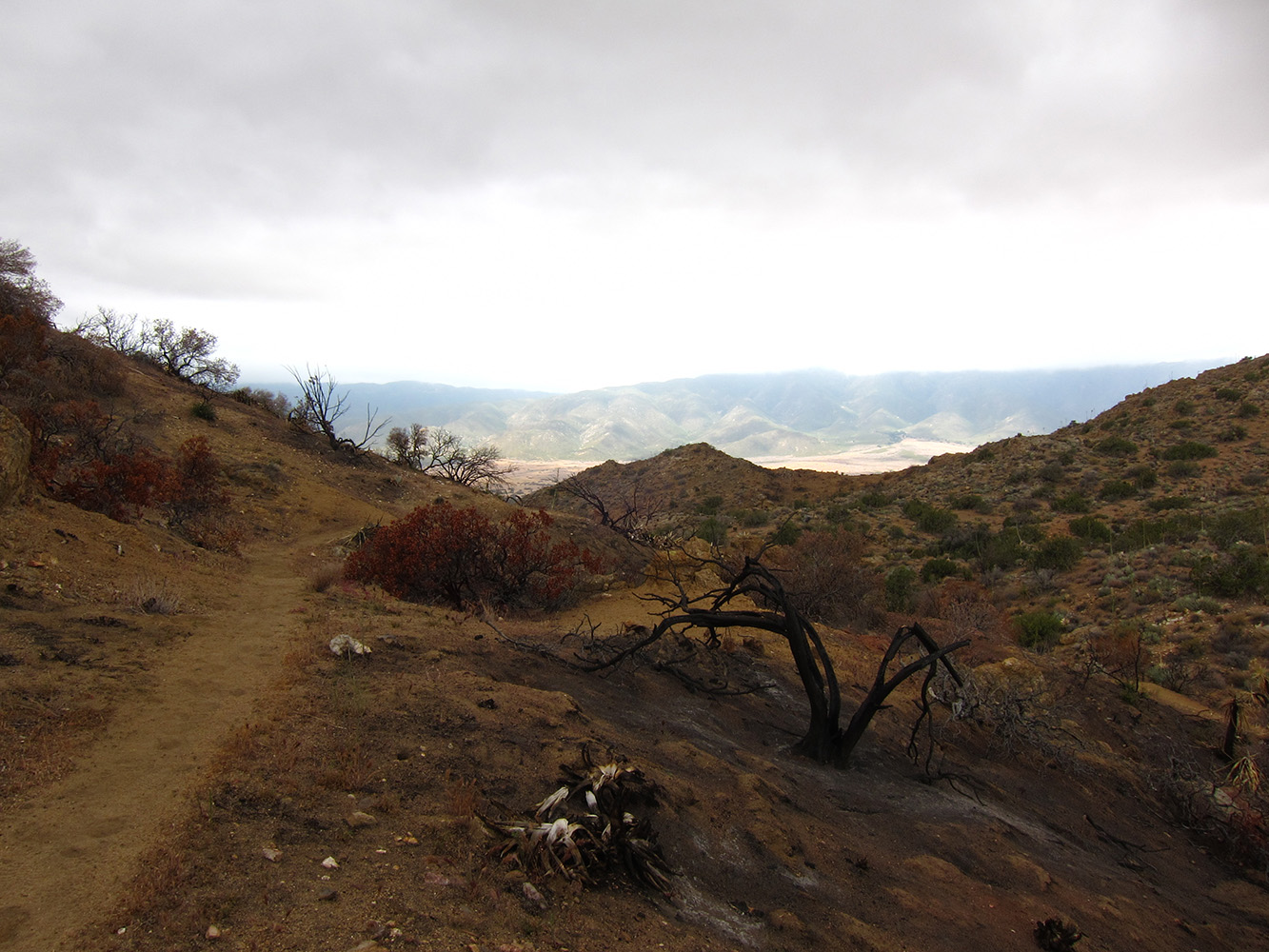
The trail wound its way around the town of Campo and out into the desert.  It was unlike anything I have experienced previously; desert shrubs growing around the husks of burnt trees and dry sand.  The trail is graded for horses and winds up and around hills.  Vast landscapes lay alongside the path as the vegetation isn't much taller than your waist. Often the trial seems cut right from the bedrock of the slope.  It makes me wonder about the history and who built each section that would eventually be linked to become the Pacific Crest National Scenic Trail.

The first twenty miles of trail from Campo are almost entirely free of reliable water sources.  I had a great internal debate about how much water to carry on the trail. Too much and the extra weight would slow me down, too little and dehydration would make things uncomfortable.  I have also never hiked twenty miles in a day before but had heard the trail was easier than most of the trails I'm used to. I ended up taking about five and a half liters, which lasted until about a mile from my first campsite at Lake Morena.  The weather was so dry and the site so free of bugs that I decided to cowboy camp, or camp without shelter for the first night.

Burnt vegetation on the trail.

The next morning I missed a turn coming out of the campground and got lost for an hour. Six miles later I began a fourteen mile climb that I would not finish until the next morning.  The temperatures rose to over ninety degrees fahrenheit and with no shade on the trail I made due with my hiking umbrella once the wind died down.  Eventually I camped in a canyon and nursed my blisters.  The next day I limped five miles into Mount Laguna, a small town, to take care of blisters and get a larger pair of shoes.  I went from a size eleven and a half to a size thirteen!  The outfitter in town was a great resource, he stocked more lightweight gear into that tiny store than you can imagine.

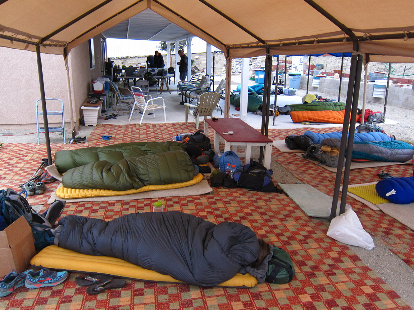
After my short day in town I did an easy thirteen miles that ended in the windiest conditions I have ever experienced. I  reached the remote campsite called out on my map only to find all the level spots where I could pitch my tent were completely exposed to sixty mile per hour winds and light rain.  Three section hikers behind me looked ahead and found sheltered sites another two hundred yards down trail so I laid low with them through intense wind and rain.  My tent had a light drip in two spots but otherwise I was warm and dry in my down sleeping bag, unlike one of the section hikers who woke up in a puddle.  The next morning was almost as wet and windy as the night but in fits and starts.

I stopped after 12 miles to let my blisters dry out rather than continue on soaked feet.  The next morning I woke a few minutes after five a.m. and felt motivated. After a cold breakfast of granola and rehydrated milk I was on the trail by six fifteen a.m.

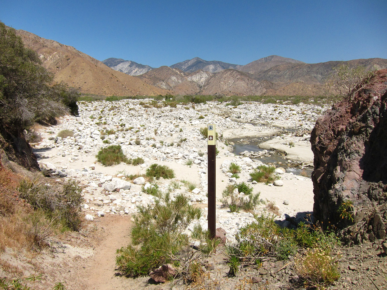
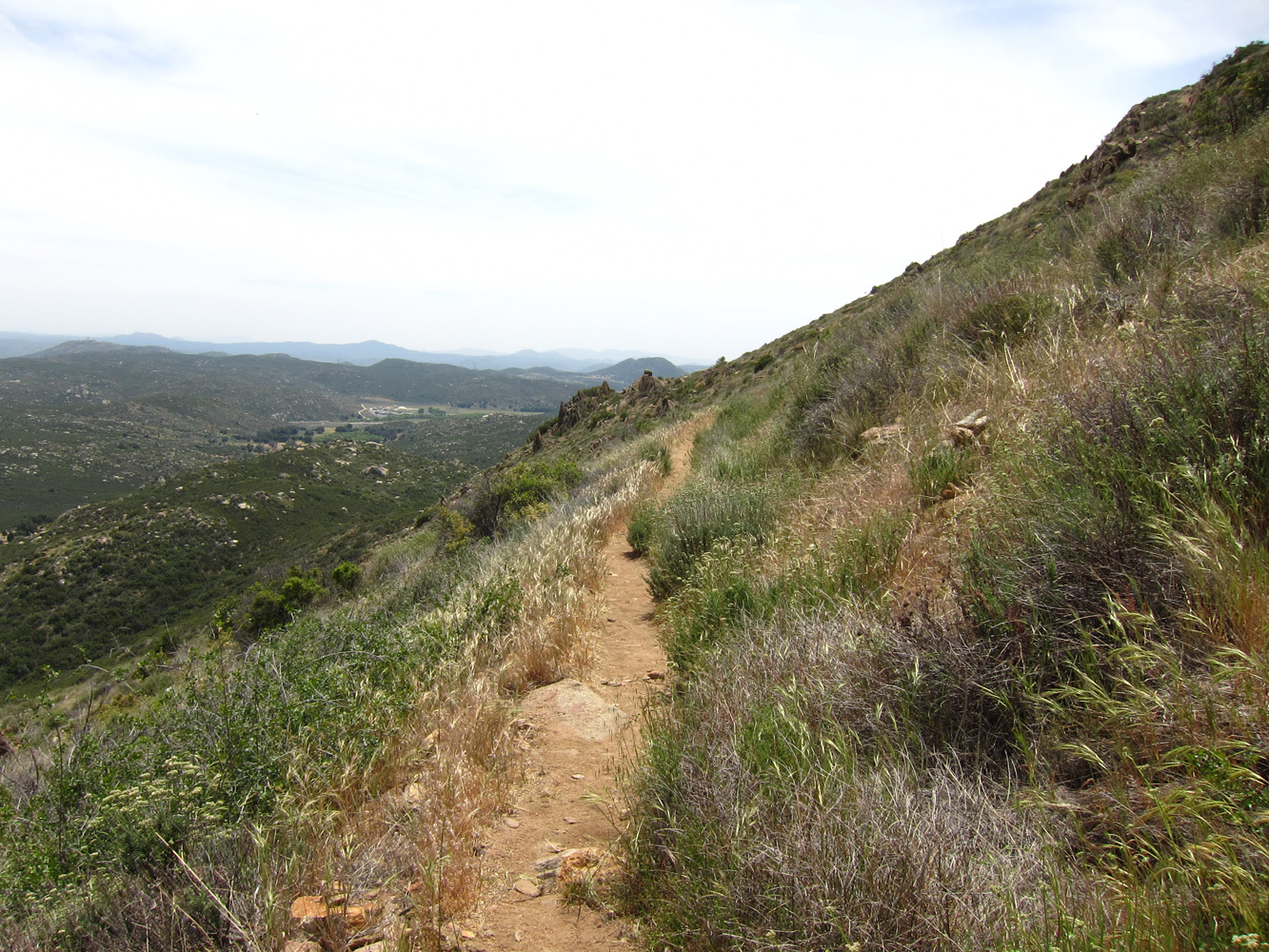
Three hours later I had made ten miles to a water cache under a highway at Scissors Crossing.

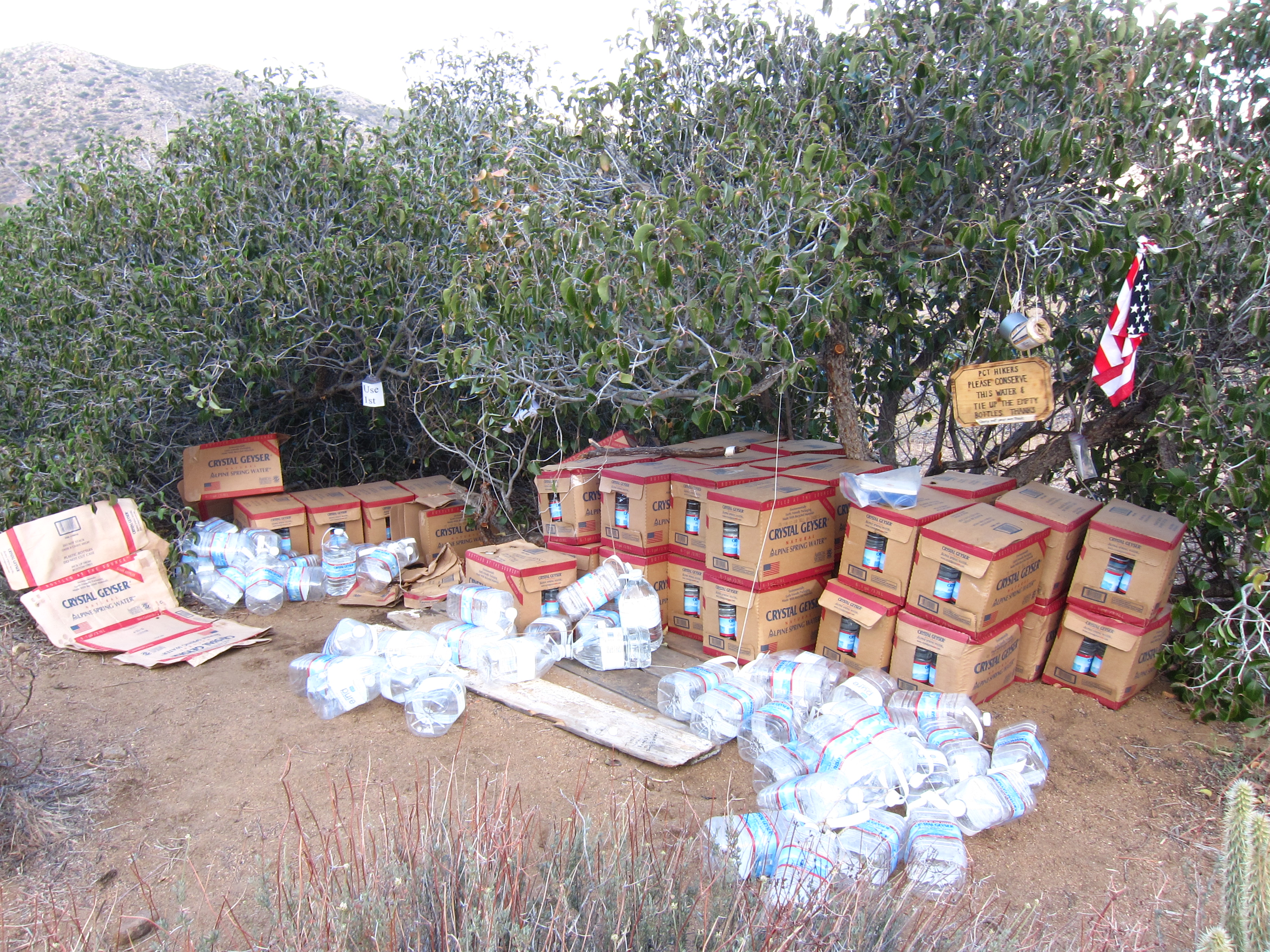
Water caches are stocked by trail angels in dry areas.

I stayed for a little while to talk to two other through hikers and the trail angel who stocks the water cache. I managed fourteen more miles by the time I set my ass down at the top of a huge ridge by another water cache.  I was feeling pretty hammered but it was only three-thirty in the afternoon!  I find I can hike very fast, typically averaging close to three miles per hour, but my blistered feet and tired ankles are limiting my range.  I think that in another week or two I'll be doing twenty-five mile days regularly.  Until then I try to stay ahead of any serious injury by doing a lot of stretching and self-massage.

Yesterday I was motivated by a community center in Warner Springs offering burgers and showers and managed to push out eighteen more miles.  I passed a mile marker at mile one-hundred and felt like a million bucks! My longest backpacking trip prior to this was twenty-eight miles and I just did a hundred!

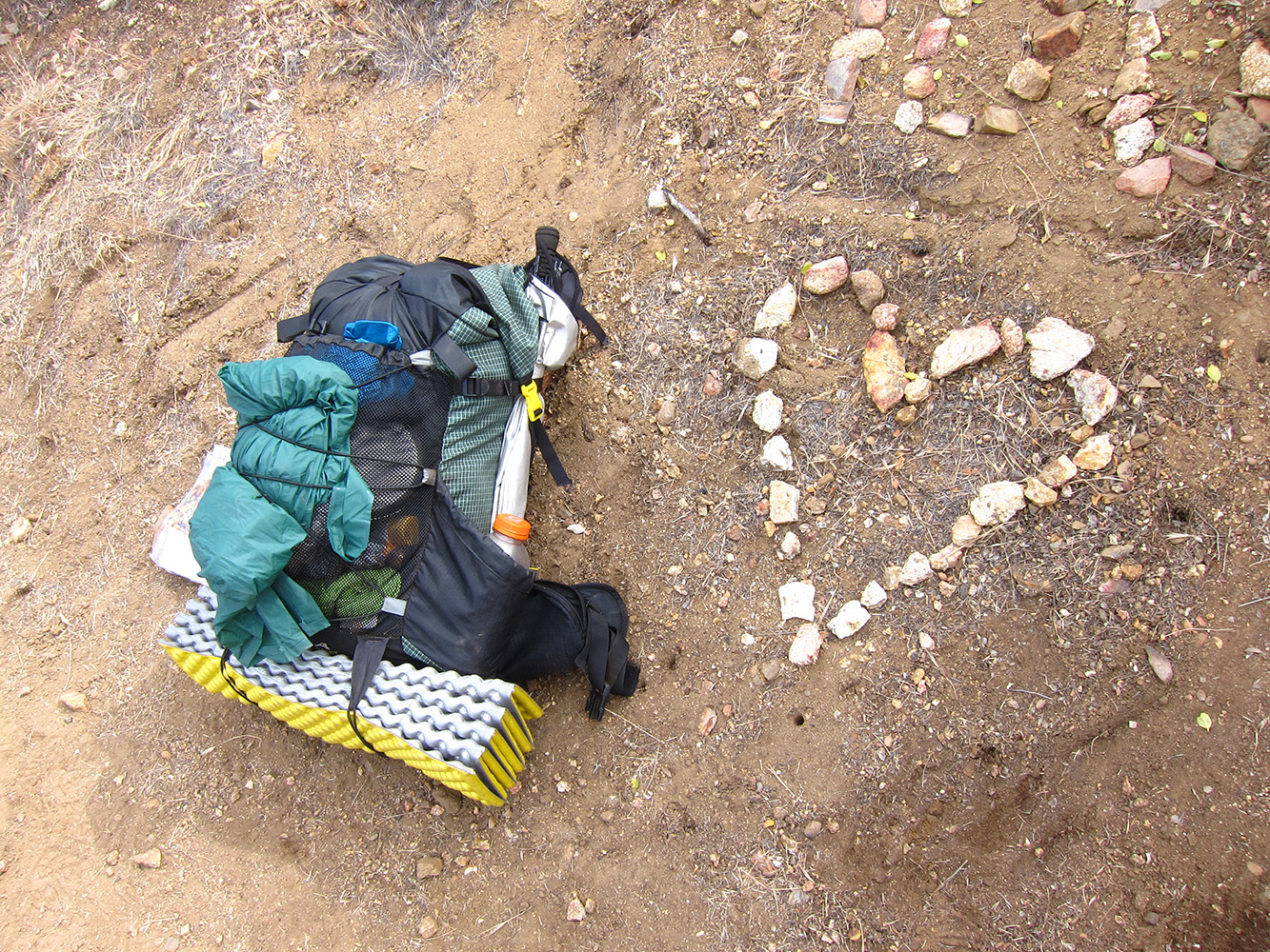
Mike's pack next to the marker for mile one hundred.

My I.T. band on my left knee was hurting, not severely but enough to make me stop often to stretch and massage it back into compliance.  I spent last night camping out behind the community center after a burger, a shower and meeting more hikers.  Overall there are many more other through hikers than I expected.  I seem to meet several new people every day and run into half a dozen I've already met who I passed or are in the process of passing me.  Everyone hikes their own pace. I enjoy hiking alone and socializing at water stops and camp sites.  I seem to have an unusual hiking style of pushing for two hours without stopping, a quick five minute stretch break and another hour or two push before taking a longer break.  I don't hike with poles so I can eat, drink and change layers all while continuing to walk.  I hope my feet will toughen up after the rest day today and I can start doing longer days continuously.  The next town is sixty-nine miles and an unthinkable ten-thousand feet of elevation gain away.  I'm taking four days of food but hope to do it in less than that.

Warner Springs to Idyllwyld - mile 180

Tuesday, May 14, 2013

I have seen physically well prepared hikers falter with bad attitudes while the physically unprepared thrive with the right mindsets.

I want to start off by saying that this hike is the hardest thing I have ever done.  I've bike toured 2,000 miles, lived in a foreign country for four months, been through five years of engineering school and worked in some fairly extreme conditions.  None of that compares to the pounding of your feet for hours upon hours, ignoring the biting pain of blisters and the dull throb of sore muscles and tendons during the third or fourth day on the trail.  Often times there are ten, twelve or twenty miles between water sources and I worry about water constantly.  Too much and I waste time and energy carrying extra weight, not to mention sweat.  Too little and my suffering increases but more important is the fear.  This is eighty percent mental after all. Fear is usually groundless and only serves to aid in preparation.  The planning and the physical make up the other twenty percent. I have seen physically well prepared hikers falter with bad attitudes while the physically unprepared thrive with the right mindsets. 

Leaving Warner Springs


While this may be the hardest thing I've ever done nothing has been as gratifying, intensely beautiful or fulfilling as seeing the trail wind its way up a mountain side, walking that trail and looking back at where you were that morning some ten or fifteen miles behind.  Knowing that you made it another day through the desert, in the sand and heat.  My blisters have healed and larger shoes are making a huge difference.  My legs seem to be toughening up for the most part and my belief in my ability to walking another two-thousand four-hundred miles (that's approximately ninety-five marathons) only increases with the miles.  I've experienced some serious low points when I have to sit and motivate myself forward up yet another climb in the roasting sun. The pay off is that the high points always blow them out of the water. 

The fatigue of the previous day combined with multiple thousand foot climbs in addition to the two trips to get off-trail water, each a mile long with a several hundred foot drop made me footsore and tired, leading up to "the climb."

Philosophizing aside, here's a quick summary of the past section: the eighteen miles out of Warner Springs to a trail angel's house at mile one-hundred seventy-seven rolled by before two p.m. but my I.T. band at my left knee was not in agreement with the success my feet were able to achieve. I slept in "the shack" on the most comfortable army cot I have had the pleasure of encountering after a dinner of ten fried tacos and a side of raw cabbage.  The next morning things seemed to be working more smoothly and I pushed out twenty-five miles to Paradise Cafe, the only water source in a twenty or so mile stretch.  I ate a huge prime rib steak, two sides of potatoes and half another hikers burger with a tall glass of Fat Tire beer to wash it down.  The meal made sleeping on the Cafe's concrete patio next to the highway much more bearable. 

I didn't know it yet but the next morning would be the toughest of the trip.  The fatigue of the previous day combined with multiple thousand foot climbs in addition to the two trips to get water off trail, each a mile long with a two to five-hundred foot drop made me footsore and tired leading up to "the climb".  Almost all of the uphill up to this point has been along wonderfully graded trail, switchbacking its way up hills, ridges and mountains.  I barely slow down for a five percent grade and ten miles later a two thousand foot climb is under my belt without much worry. 

the climb 2

"The Climb"

"The climb" was different.  Sixteen miles into the day (really nineteen miles with the off trail water and road walk from the cafe) I hit this wall of a climb, the steepest most switch backed stretch of trail yet. It took over three hours to travel less than five miles, a staggeringly slow and arduous pace compared to my usual two to three mile per hour pace.  I sweated my way up the ridge, having wisely taken a siesta until almost four-thirty p.m.  Thankfully the trail switched sides and much of the climb remained in the shade.  Still, I cannot explain the mental toll it takes to go from flying up over hills passing the less physically fit to struggling for breath at seven thousand feet up a twenty or thirty percent grade.  All of this knowing the next water awaited ten dry miles away and knowing that I would have to camp and carry an additional two liters because of it. Eventually though, like all things, it ended.

The trail wound its way around knife edge ridges finding the only walkable route, often with two hundred foot drops adjacent to the barely eighteen inch wide trail.

The top of the ridge gave way to incredible views of Palm Springs to the east and desert, mountains and more desert to the west.  The trail wound its way around knife edge ridges finding the only walkable route, often with two hundred foot drops adjacent to the barely eighteen inch wide trail.  Huge rocky peaks passed by overhead and eventually I made it to a campsite with enough flat ground to sleep on.  I arrived at seven-thirty p.m., ate and slept.  The next morning I was on trail by six-thirty a.m., not even twelve hours after the previous day with just one and a half liters of water for the remaining five miles.  My knee throbbed but I pushed to the next water source five miles away with the friends I had made on the trail passing patches of snow (which made for great slushies in our almost empty water bottles).  We congregated by the stream, elated that the climb and the dry stretch was over. After a long drink and an even longer break the final six hundred foot climb was over. Then a sixteen-hundred foot drop down to a trailhead where we talked to some day hikers into driving us into town.  Yesterday I rented a cabin with three friends, ate the biggest burrito of my life and iced my knee as much as I could.  Today I'll sleep at a campground and push on further tomorrow. 

the climb 2

Looking back after "The Climb"

Idylwild to Big Bear, or Everything Hurts

Tuesday, May 21, 2013

Twenty miles into the day I was at the first water source: a drinking fountain that made filling bottles with piss warm water in the wind a test of patience.

After a relaxing day off in Idylwild, I stuck my thumb out and hitched the three miles up to the Devils Slide trail; the sixteen-hundred foot climb back to where I departed the PCT two days earlier.  A seventy year old retired man gave me a lift and we had an enlightening conversation comparing quitting your job to hike two-thousand six-hundrd miles (me) to starting your own timber business and staying with it for forty years (him).  We said our farewells at the trailhead and I started the climb, pausing to talk to several day hikers on the way up (and encouraging them to pick up hitching through hikers).

Soon my knee was bothering me as I pushed on to the next water source a hilly six miles further, still gasping for the thin air above eight thousand feet.  The trail for the ten-thousand eight-hundred foot Mount San Jacinto stared at me in the face. As I gazed my knee throbbed and I turned in for the night early knowing twenty dry miles lay ahead.  There's always a next time for the mountain, it isn't going anywhere.  The next day started out with large ups and downs until reaching Fuller Ridge, almost sixteen miles of continuous downhill dropping over six-thousand feet to add onto the fifteen-hundred feet I had already descended that morning.  As the crow flies it is just under five miles to the bottom of the ridge, but the winding switchbacks of the PCT triple that distance.  Near the bottom I passed the two-hundred mile marker!

downhill

Downhill to Ziggy and the Bear's

Often the trail would wind seemingly in the wrong direction, heading for miles away from where the end would be.  My knees held up fine on the downhill but my insoles started to flake under my heels from the wear. Towards the bottom I developed a heel blister on my left foot faster than I could duct tape the insoles. Twenty miles into the day I was at the first water source; a drinking fountain that made filling bottles with piss warm water in the wind a test of patience.  Next to the fountain a sign reads something like "This water is brought to you by the generosity of the such and such water company, treat it as you would any other PCT water source" seemingly to mock you as the wind blows the water away from your narrow bottle mouth, unlike any other PCT water source. 

The map showed just five miles of downhill and flat to a trail angel's house called Ziggy and the Bear. Reality showed five miles of the most intense wind I have felt on the trip while walking in soft sand. (The windmill farm nearby and the narrow stretch of flat desert between two 9,000 foot mountain ranges did give me a hint that there might be some wind ahead...) I made it four miles to a highway underpass and came across empty coolers and a poster with hand written thanks from previous hikers for all the sodas and fruit.  Cars zoomed ahead in constant noise and no one else was in sight. It was a low point.  Still, in another mile signs appeared reading "Trail angels ahead!" and "Almost there! Keep going!". I came into the fenced in yard and was greeted by half a dozen hikers and the two hosts, subbing temporarily for Ziggy and the Bear.  To my surprise another five or ten hikers rolled in as the afternoon turned to evening. I took a shower, had a foot bath and gorged myself on fruit, salad and ice cream provided by the trail angels plus the ramen noodles I brought. 

Backwards felt like giving up, and forwards felt like pain. I chose forwards.

hikers asleep at ziggy and the bear's

Hikers asleep at Ziggy and the Bear's.

The next morning I was out by seven a.m., my heel blister getting worse despite the cut out piece of shoe insole I had taped around it.  The trail took me up two canyons and down to the largest natural water source in over two-hundred miles; an eighteen inch wide stream six inches deep.  At this point I borrowed a needle and thread from a friend, lanced my heel blister and left thread through it to keep the drainage flowing. I could barely walk the pain was so bad.  My calf was worn out completely from favoring the heel on the downhills and my ankle could barely move on its own.  At this point I could turn back to a nature conservancy two miles behind to heal or push on forward fifty miles to the next resupply.  I didn't have an extra days food in my back to sit and wait. Backwards felt like giving up, and forwards felt like pain.  I chose forwards.

Leaving Ziggy and the Bear's

The trail cut a confusing path across the sandy braided river valley and up and over two more seemingly endless canyons to another smaller river valley with a narrow, spring-fed stream winding through it.  After a few hours I couldn't feel my heel blister and was ignoring my ankle.  This time we climbed a steady grade inside the river valley with steep canyon walls on either side for over ten miles.  Occasionally the canyon would narrow and the shade let huge trees and grasslands flourish in the shade and water.  I camped with two friends listening to frogs croak and the flowing stream trickle.  Just as I was starting to believe I had seen all of what southern California desert had to offer this stretch of desert was unlike everything we had seen before.  It was probably my favorite part of the trail. 

A caged Bengal tiger whined and growled until just after dark a hundred yards from where I slept. 

The next day we climbed out of the canyon and back above eight-thousand feet.  Unlike earlier I felt strong, despite limping on a useless left ankle.  I passed a new group of people on a steady incline making introductions here and there.  The trail soon descended back to just over seven-thousand feet and after a small climb twenty-one miles into the day I camped near a Hollywood animal training facility.  A caged Bengal tiger whined and growled until just after dark a hundred yards from where I slept.  The cages looked tiny and I felt for the animals. Other hikers reported seeing bears but I only spotted the tiger and a baboon as I passed.

The last sixteen miles passed under my limping ankle over flat to rolling terrain through a shaded pine forest and back to open high desert. I talked my way into a ride to the Big Bear hostel with a married couple dropping off a hiker.  Yesterday I tried my hand at a pancake challenge but only made it halfway before quitting.  About three or four pounds of pancakes remained... Today will be zero day number two to let my I.T. band relax and sore muscles heal.  I may or may not leave tomorrow. We'll see.

Big Bear to Wrightwood - Mile 369!

Wednesday, May 29, 2013

Leaving Big Bear.

I ended up taking a three day break at the hostel in Big Bear Lake.  The manager offered me a job there (more like a free place to stay for a few hours of work a day) so I have a backup plan if some future injury leads to a lengthier recovery period.  The I.T. band still felt a bit funny heading on that day but after massaging a knot out of whatever muscle that runs adjacent to it the pain went away.  Of course, as soon as I recovered from that the side of my knee bone started getting store.  I think it's Iliotibial band friction syndrome, which another long distance hiker said he gets near the start of every hike and eventually goes away.  I did five miles yesterday and plan on only doing five more tonight to give it some time off. 

That aside, I felt sluggish leaving Big Bear and did between twenty and twenty-three miles a day on mostly flat to rolling terrian, descending through the alpine forests outside Big Bear around 8,000 feet to the low desert at around 3,000 feet.  Most of the trail wasn't especailly inspiring until we reached Deep Creek canyon.  About midway through the canyon is a series of natural hot springs with man made walls around them forming large pools of varying water temperatures.  I pushed myself to get 22 miles in so I could spend the night there and have a good soak.  My feet, knees, blisters ankles all hurt but once I got into the water I felt amazing! The hot springs can be reached either by the PCT or a 1.5 mile hike from a parking lot, so it does attract people.  It's also a nudist hang out but only about a quarter of the other people (and some of the hikers!) there were nude but that didn't bother me.  The book that most through hikers use for information about the trail (Yogi's Guide) really derides the place but everyone that actually stopped there loved it.  Some hikers seemed either perturbed or embarassed and walked right through.  I guess they were expecting a totally private PCT-hiker only environment? 

needs location

On Sunday, two days later, I rolled into Cajon Pass around 11 am, the location of an infamous McDonalds Restaurant half a mile off the trail. Everyone goes there despite claims of hating the place, hiker hunger is just too strong.  I honestly haven't eaten at one in five or ten years but a double quarter pounder, large milkshake, salad (need those veggies) and some chicken McNuggets really hit the spot.  I walked in with one friend, we met another we knew already there and about four more walked in over the course of the next hour or so. The prospect of a 6,500 foot climb in front of me loomed ahead and when offered a ride up trail to a trail angels house (the Saufleys) at Agua Dulce I couldn't say no.  The offer came from a former through hiker of 2010 that was between trail crews and headed north on a slow schedule.  The friend I walked in with, Guino, and I both went with him.  He claimed that there was a daily shuttle from the Saufelys to an REI near Cajon Pass so I assumed an easy ride back.  I later found out they go to a different REI in the opposite direction.  I ended up talking (or yogi'ing) my way into a ride from a guy at the Mexican place I had dinner at in Agua Dulche.  It cost $20 for his gas but saved me a sketchy hitch hike on Memorial Day for the hour long ride back to Cajon Pass.  The guy used to be a parapalegic from some disease but had regained most of his motor functions except for his fingers and the ability to walk without a cane. You meet so many characters on this trail it never amazes me. 

I got to Cajon Pass at 8 a.m. the next morning, met a new thru hiker named Skip already eating at Micky D's.  We ate together and headed out up the hill.  Skip and I hiked together for longer than I've hiked with anyone else on the trail, our paces were just very similar.  We came across an amazing water cache 6 miles in with couches and chairs.  Unknown to us at the time, two section hikers higher up on the mountain were watching us.  We caught up to them half way up the next ridge and got some fresh pineapple and sodas from their friend who was picking them up.  Around the corner was another water cache to break up the dry climb.  Skip and I pressed on until about 4:30 p.m.  He had already hiked in six miles to get to the McDonalds so that was the end of his day.  I made a bowl of ramen with him and pushed on to a campground at the height of the ridge getting there just before 7:00 p.m.  I counted it up and that day figured I hiked almost 7,000 vertical feet over twenty-two and a half miles!  I think that's the most single day climbing of the entire trip and represents over two percent of the vertical gain of the entire PCT. 

When I got to the campground I saw three other hikers I already knew: Glide On who hiked the trail in 1979, and two girls who went by Ninja Turtle and Raven Lady. I had been bouncing around with them since before Idylwild. When I saw the two girls I yelled out "Breakfast at Micky D's and dinner with my LGBTs!", they got a kick out of that. I thought I might see them there since they had signed the hiker registers at the water caches earlier on the trail. 

needs location

The next day I felt like crap and was happy to only have 5 miles to get to an easy hitch hike on Route 2 to Wrightwood.  I didn't even have to stick my thumb out because a ninety-three year old man was just getting back from his morning walk at Inspiration Point (where Highway 2 crosses the PCT the first time).  He drove me into town while telling some stories of his own hiking adventures.  He said one Memorial Day he went to hike Mount Balden-Powell (which I'll hit tomorrow) and woke up to over a foot of snow on his sleeping bag!  It's interesting because most of my rides and off trail help seem to come from either retiree's or people close to retirement that have led interesting lives.  I think it takes a few types of people to offer rides and help to strangers and most of those types make for pretty amazing people.

Most town days consist of picking up groceries and any other random things which usually doesn't take long. I had my bounce box shipped to this town (thanks Mom and Dad!) so I had a lot more on my plate.  The bounce box is actually a reused de-icing bucket filled with random things I only need intermittently and food that I can send up trail where grocery stores are lacking.   This means long term planning is involved for where the box is going and what food it will contain.  Some of the random stuff includes my camera battery charger and the backflushing thing for my filter which were both utilized at the bar.  I also had to figure out where to send the box and buy some groceries for it and the next stretch.  Fortunately another hiker, Slider, who I helped get rid of about 5 lbs of extra crap he didn't need in Big Bear wanted to buy me two beers as a thanks.  We ended up at a bar (my spot point) where I could spread all my crap out on some picnic tables, go grocery shopping and mail the box up trail to Independence without having to lug my pack around all over town.  Since we made the outside of the bar our home base other hikers naturally gravitated there and pretty soon there were eight of us hanging out.  The bartender Paul offered Slider, another hiker Chris and myself a place to stay in his house for the night.  We accepted and eventually learned that Paul used to be a CA state representative and later a big wig in the music industry.  He drove us around to his amazing house at the top of a ridge with a view of Las Vegas in the distance.  We cooked him a huge BBQ dinner as thanks and shot pool in his living room the rest of the night.  I actually did really well, must have been the Young's Double Chocolate Stout I was sipping on. 

Paul is an amazing guy but kept going off on long political diatribes against coporations, the government, utility companys, Wal-Mart, etc.  I agreed with most of what he said but not to the extreme extent of it.  Honestly though I'm not out here for that kind of crap but it was a small price to pay for an otherwise great night. 

Today I hung out at a coffee shop and will soon be leaving for the trail.  I'm planning an easy five miles to a water source and campground, then I can do twenty mile days all the way to Agua Dulche.  My brother Chris might meet me out there for sixty miles.  Keeping my fingers crossed!

Mile 373.

Wrightwood to Tehachipi - PCT mile 558

Thursday, June 6, 2013

The hundred or so miles out of Wrightwood started off with a 2,800 foot climb up to Mount Balden-Powell, a 9,500 foot tall mountain named after some kind of boyscout version of George Washington. Rather than lump everything into one exhausting day, I chose to "nero" or only hike 5 miles with two friends to the base of the mountain and camp. My friends go at a slower pace and it was nice to be forced to take it easy rather than my usual steam rolling approach. We ran into a few other hiker friends who had slack packed the section from north to south and had spent the last hour trying to hitch back into Wrightwood to get their packs. They finally caught a break when some benevolent rednecks came out of a dirt road nearby and picked them up.

The climb wasn't so bad, steep so over rather quickly. I felt ok at altitude and the weather was cool in the morning. At the top was a boyscout monument and a 1,500 year old tree. I was more impressed by the tree. The trail continued along the ridge, rolling up and down with the terrain until hitting the "frog detour". An endangered frog is said to live along a 5 mile section of trail which has been closed the last few years. I agree with the sentiment but the "official" detour is 18 miles long... Rather than add a day to my walk I chose the old official detour, four miles of trail and a 3 mile road walk. Various hiker resources called the road walk dangerous despite having shoulders and a total of 6 cars passing me in the hour long trek. That continues the theme of this trail; weigh the risks in a realistic way and ignore the over cautious fears to come out on top.

The next climb kicked my butt. 1,800 feet in the heat of the day was not fun but I got it over with, kept on trucking and made my way to a trail camp half way up a 1,000 foot climb. The camp had plenty of water and for the first time in any quantity - mosquito's. As I made camp I thought it would be nice to have a fire since they were actually allowed in the Angeles Forest so I struck up a rather pitiful one with gathered branches and twigs. Later on the sky grew hazy and I could faintly smell smoke. I suspected a wildfire but the winds were light and I had a mountain range between me and whatever was burning so I slept peacefully after a mountainous 22.5 miles.

That next morning was smoke free and I got an early start thanks to a mosquito buzzing in my ear, up before 5 and on trail before 6. I rolled along up that climb, pasta waterless empty boyscout camp andup yet another climb. Pretty soon it was 10 am and I had done almost 12 miles. The old saying "10 by 10:00, 20 by 2:00 and you have a thirty in the bag" came to mind and I pressed on. Eventually I hit some sections of trail littered with poodle dog bush, a poisonous bush said to frequently put hikers in the hospital with severe rashes. The remainder of that day and all of the next day or two later involved what became known as the poodle dog bush dance, a kind of sneaking around the large bushes to avoid touching yourself or your pack against the leaves. It really breaks your rhythm up. Where its impossible to avoid there are detours along dirt roads that I happily took advantage of. All the while a plume of white smoke grew off in the distance from the power station fire. By 3:00 I had 24 miles on the books and caught up to a group of friends that left before me the previous day. They wanted to put in another 5 miles to a campsite shown on our maps and described in the guide book. I loafed around, drank and ate for an hour and said what the hell. We headed up the 800 foot sandy climb, wound our way around the ridge to where the campsite was supposed to be only to find more poodle dog bush. Apparently the area burned and the maps and guidebook have not been updated. Rather than give up, we pressed on another 1.5 to a stream crossing and camped on the the trail, exhausted at 7:00. Still, that was my first 30.

The next day took a few false starts to get moving but we banged out 18 miles of poodle dog bush dancing and detours to a KOA "campground"/RV park/train tracks/lion preserve. I made friends with a fellow camper and the next morning pushed on the 10 miles to hiker heaven at Agua Dulche - a trail angel's house outfitted to sleep 50 hikers. There we were informed that the next 60 miles of trail was closed due to fire and they were organizing shuttles to "hikertown", the next trail angel spot right smack in the middle of the Mojave desert. My day off included an expensive trip to REI for new shoes, new socks and a new shirt. After my day off I took a morning shuttle with friends, we waited out the heat of the afternoon in the bizarre collection of eerily quiet fake buildings. I left around 6:30 with some friends and we rolled the pancake flat walk along the California Aqueduct together. Rather than hike all night like the others, I spurned the crowd and stopped to make camp at 10:00 that night after making almost 10 miles. One friend joined me, another 10 or 15 passed us in the night. We woke around 4:45 and got on trail by 5:30, finishing the six miles to the next water source - a cache under an aqueduct bridge. On the way we passed almost all of those who left after us and attempted the hike all night, apparently too tired too continue to their 16 to 24 mile goals. At the bridge most of them caught up, too sleep deprived to continue but citing the 85 degree heat at 8 am. My well rested friend and I pushed on, conquering a 1,200 foot climb to make it to a long siesta at a canyon side creek by 11 am. We slept out the heat of the day and left the shade and water at 4:45. More climbing continued to a well stocked cache of apples, water and furniture. Eventually we stopped 2 miles later around 9:30 that night to dry camp on the saddle of a burnt ridge. This morning left 8 downhill miles and a ride into town. Our ride even stopped by the post office and grocery store making this the ugliest but easiest resupply day of the trail.

Tehachipi to Kennedy Meadows - Mile 702!

Saturday, June 15, 2013

A week ago Friday afternoon, if you had driven down one of the innumerable dirt roads intersecting the PCT between highway 58 and Walker Pass, you would have come across myself and three other hikers laying in the shade. It would have been 106 in the sun and 97 degrees in what little shade was offered by the Joshua trees and anemic pines. I probably would have quit right then; ten miles in and nine mountainous miles from the nearest water with only two liters of piss warm water in my possession left from the five I started with. A hair drier would have cooled us down better than the wind that day.

At 2 pm, a legendary hiker named Lint walked by the four of us, half naked and slumped sweating in the shade, as if nothing was wrong. His pack weighs 6 pounds without food or water and he averages somewhere around 35 miles a day. This is Lints 10th through hike. I asked how much water he took for the 19 mile dry stretch and he said three liters as if it was normal. I don't know how that's humanly possible in the heat we had that day with 2,400 feet of climbing just around the bend. 5 pm rolled around and we managed to get out of our heat comas and start walking. We all made it to that next spring, none of us with a drop of water left and all severely dehydrated. Cold water never tasted so sweet. I never saw Lint, he must have pushed on.

Friday came after Thursday, only 103 degrees for 24 miles. That day started out cool, I did the 8 miles between highways over easy terrain in the morning. Unfortunately I had to get out of town and the earliest ride I could arrange from a trail angel left town at 8 am. The late start meant I got to the base of the days first big climb close to the heat of the day. My pack was the heaviest so far with 6 days of food and 5 liters of water for the remaining 16 miles that day and 5 and a half days after that. I thought I was more hydrated than I was and made the mistake of not drinking a huge quantity of water at the start. Near the base of the climb I stopped, covered in sweat and decided to take a long siesta until the weather started to cool. With 14 miles left I wanted to get to camp at a reasonable hour and started moving too early, at only 4 pm. It was still incredibly hot and I sucked down two liters in only a handful of miles. There was no way to keep going like that, so I stopped again until 6. The climbing and the remaining heat ate away my water and I was on the verge of running dry eight miles from the spring when a friend gave me most of a liter. Even so, as darkness set in, I was out of water with an unknown number of miles to go. When your mouth runs dry your mind starts to wander in the dark space around your headlamp light.

Around 9:30 I passed a friend, Tee-Cozy, camped on a flat spot just off trail and asleep. I kept moving, thirsty. At 10:15 I started to question where I was and whether I had passed the spring; it was 18 miles to the next one. My thoughts went something like this: Where's the spring? Did I pass it? I can't see the ridge when its this dark. Tee Cozy started 8 miles ahead of me, why did he stop there? Was that the spring? Did I look at him and miss the water? I think the trail was narrow there… No the topo didn't match. I'm supposed to hit a switchback right before it. Maybe that was a hairpin back there? 15 more minutes and I'll stop to… reconsider? 15 more minutes. Let me check the map again. Why am I on top of this ridge when the topos show me on the side of it? Is this the PCT? Yeah there's a sign, thank fucking god. Ok there's a dirt road a mile after the spring and I definitely haven't crossed one. Just a little while longer. The switchback! This is it! Wait, why am I on a dirt road?

At that moment I looked to the right and saw two hikers asleep on the road. One woke up and told me not to camp at the spring because of the cows. It was right around the corner. I didn't bother to wait for a bottle to fill under the cold trickle falling from the pipe, I just drank straight from the falling water. After drinking two liters and eating dinner I tried to sleep under the whine of nearby windmills. Up at 5 am for another hot day.

Sunday was much cooler with less climbing. There was still 20 miles between water sources but a cache was well stocked so I filled up there. The next water was 2 miles off trail and the cache would save me almost two hours just for water. I dry camped seven miles from the next cache which broke a 30 mile dry stretch. I would have been thirsty that night but two friends pushing all the way to the cache each gave me a half liter. I bought them a beer here in town as thanks. The next day I felt frustrated on the way to the water cache, tired of the dry desert and ready to get out of the Sierra. The long downhill to the cache was rocky and didn't seem to end. When I got there the 75 year old woman who stocks it rolled up in her pickup with the bed full of gallon jugs. It's incredible how many hikers come to rely on her two caches that make our lives so much easier. I started to help her unload when another hiker caught up and helped. Between the three of us the full jugs were unloaded and tied up and the empty jugs put into the truck in only twenty minutes. She said sometimes there would be no one here and she would have to do it alone. Amazing.

Immediately after the cache is a 1,600 foot climb, rolling flats and then downhill to walker pass over twenty miles. The day went by but my mood was shit. I was sick of the dry heat and the long distance between water. I just wanted to get into the Sierra and out of this hole of a desert. Around 5 pm I finished the 27 miles to the campground at Walker Pass only to find the last day of a 14 day barbeque for PCT hikers! A trail angel was still there, grilling hot dogs and making pasta. Not only that but one of my old friends I hadn't seen in over 300 miles was there with his dad. I gorged myself on food and caught up on the last few weeks. I had taken 3 zero days in Big Bear and finally managed to catch up when he took some days off. The next morning was breakfast burritos and more fruit. It was like someone hit the reset button on my mindset and I was back to loving the trail again, surrounded by amazing people and good food.

The 50 some miles to Kennedy Meadows were hilly but not as hot. They rolled by in two and a half days. I've spent the last day and a half recuperating here after hiking 184 miles from Hikertown in 9.5 days with no rest days. I hope it prepared me enough for the Sierra's 12,000 foot passes and Mount Whitney – the highest peak in the lower 48. I'll be carrying a 2.5 lb bear can but won't have to carry more than two liters of water because of all the lakes and streams.

a caption

Kennedy Meadows to Kearsarge Pass - Mile 787

Sunday, June 30, 2013

Forester Pass, Sierra Nevada

I've made it to mile 906 and am in Mammoth Lakes, CA.  My last resupply at Kearsarge Pass didn't leave me enough time to do a write up of the section but I have time now.  You have to realize that every time I get to town I'm planning for a 5 to 7 day backpacking trip in the space of a few hours.  Laundry, showers, dinner, food shopping, organizing, packing and planning all take time and these blog posts are secondary to all of that.  I'm actually writing this from a hotel computer but staying at a campground since the library is closed and all the hotels are booked or double their normal price due to some motocross race in town.  If they don't figure out I'm not a guest here I'll post a write up of the last section and possibly pictures.

I rolled into Kennedy Meadows with the idea of taking three days off to let my body recover for the Sierra Nevada's.  I also knew my brother was going to visit but the area lacked any cell phone coverage so I could only get to him by email which he answered in typical California style (infrequently and vaguely) so I didn't know when he would get there or where he would be.  The town is not really a town, just a general store and some vacation and ranch homes.  One of those happens to be Tom's Place, a hiker centered compound of ancient RV trailers, an amphitheater and outdoor kitchen all wrapped inside an expansive nine hole disc golf course.  There were easily thirty or forty other hikers staying there which made for good times.  The general store had all the ice cream, beer and burgers a hiker could eat.  Chris got there on Saturday afternoon with his lady friend Clio so we went for a swim at the Kern River just half a mile away from "town" and went on a tour of Tom's place to meet my hiker trash friends.  The long stay let friends I had passed catch up, including Magic Mullet aka Teen Wolf aka Thunderdome who has to end his hike early in 200 miles and get back to school.  We hiked together from before Kennedy Meadows through Big Bear until I took a few more days off and didn't see him until Walker Pass, just fifty miles earlier.  I thought I would see him on the trail the day we both left but I must have gotten too early a start. Sorry man!  The next day was a long winding drive up a mountain to 9,500 feet (Bald mountain?) to see an active fire tower and view Mount Whitney, the tallest mountain in the lower 48 (14,505 feet) and my next major destination.  I had some fun on the drive down and we hung out the remainder of the day and hiked the 2 miles from town to the Kennedy Meadows campground for some awesome dinner.  The following morning I had to return to the PCT after a delicious bacon and blueberry pancake breakfast.

Kennedy Meadows is considered the start of the Sierra Nevada's even though the foothills really started around Walker Pass about fifty PCT miles earlier.  Even so, you're still in the desert and have to climb 4,500 feet in twenty miles before you really hit the alpine environment.  Half way up I hit the South Fork of the Kern River with a sweet campsite and some friends who were out fishing for trout.  I could either stop there for an easy day with friends or keep trucking to finally put an end to the desert and get into what's considered the most beautiful section of the 2,650+ mile PCT.  The same drive to finally be done with the hot dry desert kept me moving and I camped alone, 18 miles in, near the top of the climb.

The next day I found myself hiking alone through a new alpine environment, past more water sources than 100 miles of desert hiking.  It's an odd feeling to be so excited about something as simple as water and mountains.  The next two days took me up to 11,500 feet, a new high altitude and left me gasping for breath on moderate inclines.  On the way to Crabtree Meadow near the base of Mount Whitney I ran into a new group of hikers and we pushed out the last ten miles to our campsite for the next two nights.  We would leave all our camping gear and most of our food at the base to take just clothes, water and snacks to the top. The mornings had been below freezing so we got a late start at around 8:45 to begin the 4,000 foot climb to the top of Whitney.  Even after camping near or above 10,000 feet for the last three nights I felt like crap from the beginning.  It could have just been nerves or the altitude but it felt like I only had one lung working.  My three new friends took a long break three miles in and I decided to push on alone.  At 12,000 feet the lack of oxygen felt even worse and I struggled to find a pace I could sustain without stopping frequently.  At close to 13,000 feet I took my first real break to eat and drink.  For some reason after that I felt almost normal and hauled ass up to the ridge that takes about 2 miles to slowly work its way to the summit.  On the way I passed numerous John Muir Trail hikers starting or finishing their ~200 mile hike at the summit.  Half a mile from the summit I started seeing familiar PCT faces who had left Kennedy Meadows the day before me but taken longer to get to Crabtree Meadows - Tee Cozy, Cream Tea, Piper and Crusty were all there.  When I got in view of the hut on top of the summit I was so excited I actually ran the last 100 feet, not a great idea at that altitude.  The views were incredible but the cold wind meant I had to change out of my wet clothes and put all the layers I brought with me on.  I was amazed that the climb took just over 4 hours from lower Crabtree, it had felt like so much longer.  The mountain is really just a big boulder covered lump, not what you would expect for the tallest peak in the 48.

The way down went easily but I learned one of my friends was leaving the PCT due to stomach troubles, possibly giardia.  We took our time and camped together and he went south to the nearest trail exit.  The next day I pushed on with Piper who had been hiking with Crusty and we made it over the tallest point in the PCT - Forest Pass (13,500 feet), catching Rustic along the way.  The views were even better than Whitney and we met some sucessful through hikers from 2011, a record snow year where 90% of the trail in the Sierra was under 4 feet of snow or more!  They were doing trail magic at the next meadow which gave us a good end destination for the day.  The way down from forester pass takes you into Kings Canyon National Park which is probably the most amazing part of the trail.  You hike into a narrow forested canyon with huge granite peaks on both sides of you that have near vertical sides and snow packed into crevices.  We all made it to the trail magic at Vidette Meadow and had a great time eating the provided pasta and candy and telling stories.  Someone left a toy sheriffs hat there so I did an impression of a hick sheriff patrolling the John Muir Trail ripping up hiker permits.  I told the two guys doing the magic I would carry the hat at least to Sonora Pass - about 300 miles.

The next morning was a steep climb up to Kearsarge Pass, an exit point off the PCT.  You have to hike 7.5 miles off trail with a 2,000 foot climb up to 12,000 feet or so just to get a resupply.  Tee Cozy, Piper and I had a hard time hitching to Bishop for Resupply so I didn't have time to write this up then.  We split a fancy hotel room but Piper had to stay an extra day for an important package since it was Saturday.  I also got screwed since my bounce box was there but I couldn't get to it or mail it forward.  I am screwed yet again since I got here at Mammoth Lakes on a Saturday and can't get mail again...

Tee-Cozy and I started hitching back to the Kearsarge trailhead at 9:45 the next morning but didn't get to the trail until 2 PM!  I booked it up over Kearsarge and over Glenn pass to camp at Rae Lakes but that's for the next post.  Maybe I'll write it up later.

a caption

Finally a computer! Update through mile 1425 - Burney Falls State Park

Thursday, July 25, 2013

I apologize for the lack of updates (well not really) but I've been moving fast and the availability of computers has been extremely limited.  I haven't taken a day off in over 500 miles so it's been almost impossible to find the usual 2 to 3 hours it takes to update this blog.

I'll try and give a brief update starting after Kearsarge Pass, about mile 787.

The hitch back from Bishop to Kearsarge Pass (mile 787) was extremely difficult.  Weekends in town bring tourists with families who know nothing about the PCT and would rather smile and wave than pick up a hiker.  What's funny is how positive the interactions I have with drivers always are, if only the ones that pass me by had any idea. Tee Cozy and I had split a hotel room together the previous night and started hitching at the edge of town at 9:30 AM.  Even holding a sign with money on it brought no rides.  About two hours later finally a father and his son on their way back home stopped and picked us up.  They were friendly and eager to hear about our trip but unfortunately not headed all the way back to the trail head, so our hitch continued in Independence.  Another hours wait on the road with thumbs out did nothing but a small pickup happened to stop up the road from us to pick up a geologist interested in diorite dikes in the Sierra.  I walked over and talked our way into a ride in the back of the covered pickup which had been converted to a bed.  We finally got back to the trail head at 2 pm with a 7 mile hike just to get back to the PCT.  I made it back on trail and pushed over the next pass (Glenn Pass?) to camp at Rae Lakes - a beautiful series of lakes but rather buggy.

The next few hundred PCT miles consisted of traversing high mountain passes over 12,000 feet, then descending to between 8,000 and 10,000 feet into elongated grassy meadows bordered by steep mountains.  The glaciers had pressed the meadows down and deposited a sandy bottom that saturates each spring with snowmelt and keeps the trees from growing in.  Each pass was unique, some appear on the horizon as shear rock walls towering a thousand feet that leave you wondering how the trail could possibly wind its way up and over.  Others consisted of winding canyons leading slowly up hill past lakes and rivers of spring snow melt.  Often our maps warned about dangerous stream crossings from snow melt but this years low snow meant we could almost always rock hop across or just get wet up to our ankles.  Slowly the passes get lower and the meadows become shorter.  At Reds Meadow I took a bus into Mammoth Lakes (big ski town) and picked up a frozen 6 ounce filet mignon, pound of bacon and 5 eggs to eat on the easy 36 miles before Toulome Meadows.  The filet mignon was cooked on my beer can alcohol stove in front of a group of trail workers camped out at the PCT trail head in Reds Meadow.   The eggs, bacon and some black bean mix were shared as breakfast burritos with another hiker, Milo, surrounded by hundreds of mosquitoes frustrated by our rain gear and head nets.  I ate the rest of the bacon on top a 10,000 foot pass, surrounded by puzzled/jealous hikers.

In Toulome Meadows I took a day to hike into Yosemite to Clouds Rest with another PCTer - Rustic.  Clouds Rest is a sheer granite knob extending above Half Dome with 360 degree views of Yosemite.  A thunderstorm rolled into the valley as we approached the summit and scared the crowds off, even though the thunder was twenty miles away.  I saw some hikers I first met in Kennedy Meadows (400 miles ago!) - Oatmeal and Dandy Greens, a couple from Colorado.  The next day I started a difficult 152 mile stretch to South Lake Tahoe split in the middle by Sonora Pass.  In that section the meadows become shorter and the passes steeper. The climbing was generally steep, rocky and the heat hotter. Approaching Sonora Pass everything became a moonscape of broken gray rock with almost no vegetation.  Near the top I met a couple out for an overnight backpacking trip who asked me where I started from.  When I said Mexico, they said they were from Mexico and immediately peppered me with questions!  I was in a hurry to get to town and mail my borrowed 2.5 pound bear can home (Alison I'll have my folks mail it your way soon!) so we parted ways.  I got to the road, temporarily passing Oatmeal and Dandy Greens and hitched to Kennedy Meadows Resort (different from mile 702 Kennedy Meadows).  The resort is really just a store, restaurant, RV park and dozen or so cabins but they let hikers mail bear cans home for $15.  When I walked into the restaurant for dinner I saw the two weekenders from the top of Sonora and they invited me to share dinner with them!

After resupplying at the store I camped nearby and had an easy hitch back to the trail head at Sonora Pass. 3 days later I arrived at the highway leading to South Lake Tahoe, stuck out my thumb and within two minutes a woman pulled over.  She was a teacher on summer vacation and when I told her about my mountain biking she immediately thought of her husband, also a mountain biker.  She drove me to the post office, motel and then came back a few hours later with the husband and took me out for a sushi dinner in town.  Afterwards they dropped me off at Harahs, a casino with an all you can eat buffet infamous to PCT hikers where I met Oatmeal and Dandy Greens for a second dinner.  I stuffed myself and headed back to the motel on a bus on the verge of puking up some very expensive free food!  I will always be grateful to the amazing people that help out a tired hungry and smelly hiker!

I left South Lake Tahoe for an easy 8 miles with some through hikers I'd never met before. By not taking any time off in Tahoe I seemed to pass a lot of new people. We crossed some very rocky trail and camped near Aloha Lake, a beautiful spot with almost no bugs!  Amazing for the lake, I think the lack of soil of any kind in the area must somehow inhibit the bugs?  The next day I started doing my usual 25ish miles a day, solo but ran into a hiker I last saw leaving Tehachipi almost 1,000 miles ago - VP (Vegan Paul).  The terrain became more gradual and wooded so the views were fewer but the hiking easier. I rolled into Sierra City a few days later and ate my fill of burgers and ice cream at the tiny store/grill in town.  The owners of a bed and breakfast open their backyard and first floor to hikers.  It makes things a lot easier when there is easy lodging in town.  As I was sitting in town, Oatmeal and Dandy Greens showed up!  Since we had been running into each other we decided to hike together for a while.  A little while later Rock Steady, a hiker I met on my second day and hadn't seen since Big Bear (~mile 350) showed up too!  It's amazing how you met and lose track of people on this trail.

Dandy Greens, Oatmeal and I hit the trail the next morning, starting a 2600 foot climb up the Sierra Buttes - the very end of the Sierra Nevadas.  Hard to believe we had been in the same mountain range for 500 miles.  The section was fairly hilly and after another 2,000 foot climb we saw a sign advertising a trail angel in Bucks Lake, a tiny town we originally intended to skip.  At the time we decided to pass by but when we got to the road, there was Nancy the trail angel picking up two hikers ahead of us.  When she offered burgers we couldn't say no and took her up on the offer.  We ended up staying after getting fed a huge lasagna dinner (after the burgers) and a huge breakfast of pancakes, eggs, grits and bacon!  Also staying there was a PCT hiker who is giving cello concerts along the trail named Cuddles.  The only way the university he works for would let him go was if he gave concerts along the way so his wife drives to the locations with his cello and he plays for an hour or two.  He gave a short prequel concert to us since the actual concert was the following night and it was amazing.

The next day we descended 5,000 feet to Belden, passed through and climbed back up over 5,000 feet into Mount Lassen National Forest and eventually to the PCT half way marker at mile 1326! Shortly after was Chester but it was 100 degrees and every motel with air conditioning was booked! Since it was the weekend the library was closed so we decided to just pass through and keep pushing.  Another day brought us to Drakesbad Guest Ranch which was talked up as hiker friendly in the guide books, promising huge dinners for cheap prices and free swimming in hot springs!  Sadly the ownership changed last year and they no longer serve hikers like they used to, unless you want to pay $150 a night to stay there.  Disappointed, we left that evening and night hiked another 6 miles or so.  Coming into Drakesbad were mud pots and steam vents heated by magma in the earths crust, which was interesting but the heat did not let me stay very long.  The next day we put in 21 miles to get to Old Station just as the heat reached 100 degrees yet again.  On the way in we ran into Double Sprainbow and Roid Trip, a couple who I last saw just before Mount Whitney and had since gotten married at a trailtown by a newly ordained PCT hiker!  It was awesome to see them again!  Unfortunately they're pretty slow so it might have been the last time.

In front of us lay the Hat Creek Rim, a 30 mile dry stretch along a ridge of volcanic rock formed by a fault in the earths crust.  A south bounder several hundred miles ago told me about the water cache 18 miles in, supposedly huge and with a phone number to call if it ran dry.  Still, with the heat above 100 during the day I had visions of the stretch out of Tehachipi and took 4 liters to camp that night and make the cache early in the morning.  Oatmeal, Dandy Greens and I left the store at Old Station at 5 pm and got to a lava tube along the trail around 6:30.  We took our time walking inside the cool tunnel formed by fast flowing lava long ago and hiked out to the top of the rim to watch the sunset hit Mount Lassen and Mount Shasta way off in the distance with VP.

That night we hiked until 11 pm and slept only 5 hours, waking just after 4 am to finish the exposed hike along the rim.  We came into the highway that leads to Burney (where I am now) at 3 pm but had a hard time hitching.  I called a motel in town which happens to work as a network for trail angels who give rides to hikers and got us a ride to town!  As we waited for our ride in the shade a 71 year old Japanese hiker named Toyo showed up.  He speaks just enough english to get by and amazingly I saw him last after Reds Meadow!  I have no idea how he's keeping up with me but it's incredible.

In Chester I had to take care of some logistical problems.  I had tried to order a Golite umbrella to arrive there but they shipped it to my billing address by mistake.  Hopefully a new free umbrella is waiting for me in Dunsmir.  I also ordered some shoes which were promised to be shipped overnight to Burney Falls State Park.  Sadly they did not arrive yet.  So I'm stuck here waiting for them for a few more hours.  Honestly though I'm pretty tired so this probably works out for the best.

a caption

California finished!

Wednesday, August 7, 2013

I have to make this quick since the library computer only has 10 minutes remaining!

The hiking out of Burney was some of the easiest of the trail so far - smooth, soft tread with small well graded hills and generally shaded.  A nice change of pace from the volcanic hat creek rim.  I lost my hiking partners Derrick and Michelle (Oatmeal and Dandy Greens) since I had to wait for shoes in Burney, so it was odd being alone again.  I only saw a handful of other hikers on the trail too, must be in a gap between crowds or something.

At Dunsmuir I had to wait until Monday morning to pick up my umbrella and a care package from my old friend Kastle at the PO.  To kill time I wandered around town and heard I could camp down by the river.  On the way down a drunk shirtless man with a dog started yelling for my attention.  That sort of thing seems a bit odd so I just walked faster and started a conversation with a guy, Mike, working on his log splitter in front of his house.  I told Mike about the man and when he saw the drunk guy he said "Oh that's just Ben.  He's harmless".  Apparently the town drunk wanted to hang out.  I slept in Mikes yard that night between freight trains that rolled by and saw my first bear up close that wanted some garbage.  Some yelling and clapping got him to leave pretty fast.  Mike drove me to the PO and trail the next morning. The best part was picking two quarts of wild blackberries in his yard and hiking out with some.

After I-5 the geology went back to craggy mountains with over 6,000 feet of climbing the first 25 mile day out.  Smoke from a giant wildfire in Oregon rolled in as I climbed away from the highway and obscured all the views. I booked it to Etna, another hilly 75 miles in two and a half more days.

Etna was a great little town that I wanted to spend more time in but a wildfire started by an arsonist on the opposite side of the PCT was getting out of control.  Rather than risk getting stuck behind a trail closure I pushed out of town first thing the next morning and made the 55 miles to Seid Valley in two days.  Blackberries along the trail made progress slow...

Of course getting into town means a giant descent and this one had a particularly large ascent out with some added climbs - 7,500 feet in just 24 miles!  I was beat at the end of the day, did another 26 hilly miles and then 13 more into town.

Times up! See you next time!

a caption

title

date

a caption

title

date

a caption